

Are you the author? Sign in to claim
Google Maps MCP Server: Connect AI Agents to Places, Directions, Geocoding & Roads APIs. Deployed on Kubernetes.


![]()
![]()
![]()
![]()
Production-ready Model Context Protocol (MCP) server for Google Maps Platform APIs.
Empower your AI agents with real-world location intelligence: directions, places, geocoding, traffic analysis, and road network data—all through a standardised MCP interface.
| API | Tool | Description | Use Cases |
|---|---|---|---|
| Places API | search_places | Find points of interest near a location | Restaurant recommendations, gas station finder, POI search |
| Places API | get_place_details | Get comprehensive details for a place | Opening hours, websites, phone numbers, accessibility info |
| Directions API | get_directions | Get routes with real-time traffic | Route planning, ETA calculation, alternative routes |
| Directions API | get_traffic_conditions | Analyse real-time traffic congestion | Commute monitoring, delay estimation, fleet routing |
| Geocoding API | geocode_address | Convert addresses to coordinates | Address validation, location lookup |
| Geocoding API | reverse_geocode | Convert coordinates to addresses | Location identification, address lookup |
| Distance Matrix API | calculate_distance_matrix | Multi-origin/destination distances | Fleet routing, delivery optimisation, travel planning |
| Roads API | snap_to_roads | Snap GPS points to road network | GPS trace cleaning, route reconstruction |
| Roads API | get_speed_limits | Retrieve speed limit data | Fleet safety monitoring, compliance checking |
| Elevation API | get_route_elevation_gain | Calculate elevation gain and profile | Cycling/hiking planning, fuel efficiency |
| Compound | calculate_route_safety_factors | Assess route safety risks | Fleet safety, insurance scoring, driver assistance |
uv pip install google-maps-mcp-server
pip install google-maps-mcp-server
git clone https://github.com/ettysekhon/google-maps-mcp-server.git
cd google-maps-mcp-server
uv sync
Create a .env file in your working directory:
GOOGLE_MAPS_API_KEY=your_maps_api_key_here

LOG_LEVEL=INFO
MAX_RESULTS=20
Or set environment variables:
export GOOGLE_MAPS_API_KEY="your_maps_api_key_here"
# Using the installed command
google-maps-mcp-server

# Or using Python module
python -m google_maps_mcp_server

# Or using uv
uv run google-maps-mcp-server
See DEPLOYMENT.md for full instructions, troubleshooting, and architecture details.
# Set your API key (or create a .env file)
export GOOGLE_MAPS_API_KEY=your-key

# Build and run
make docker-run

# Verify (in another terminal)
make verify-local
# Set environment
export GOOGLE_CLOUD_PROJECT=your-project-id
export GOOGLE_CLOUD_REGION=europe-west2

# First time: create secret
make deploy-secret

# Deploy (build, push, apply)
make deploy-all

# Check status
make deploy-status
# Rebuild and push new image
make deploy-build

# Force pod to pull new image
kubectl delete pod -l app=google-maps-mcp-server

# Watch for new pod to be ready
kubectl get pods -l app=google-maps-mcp-server -w
Verify your deployment using the official MCP Inspector:
npx @modelcontextprotocol/inspector
http://<EXTERNAL-IP>/sse (or http://localhost:8080/sse for local)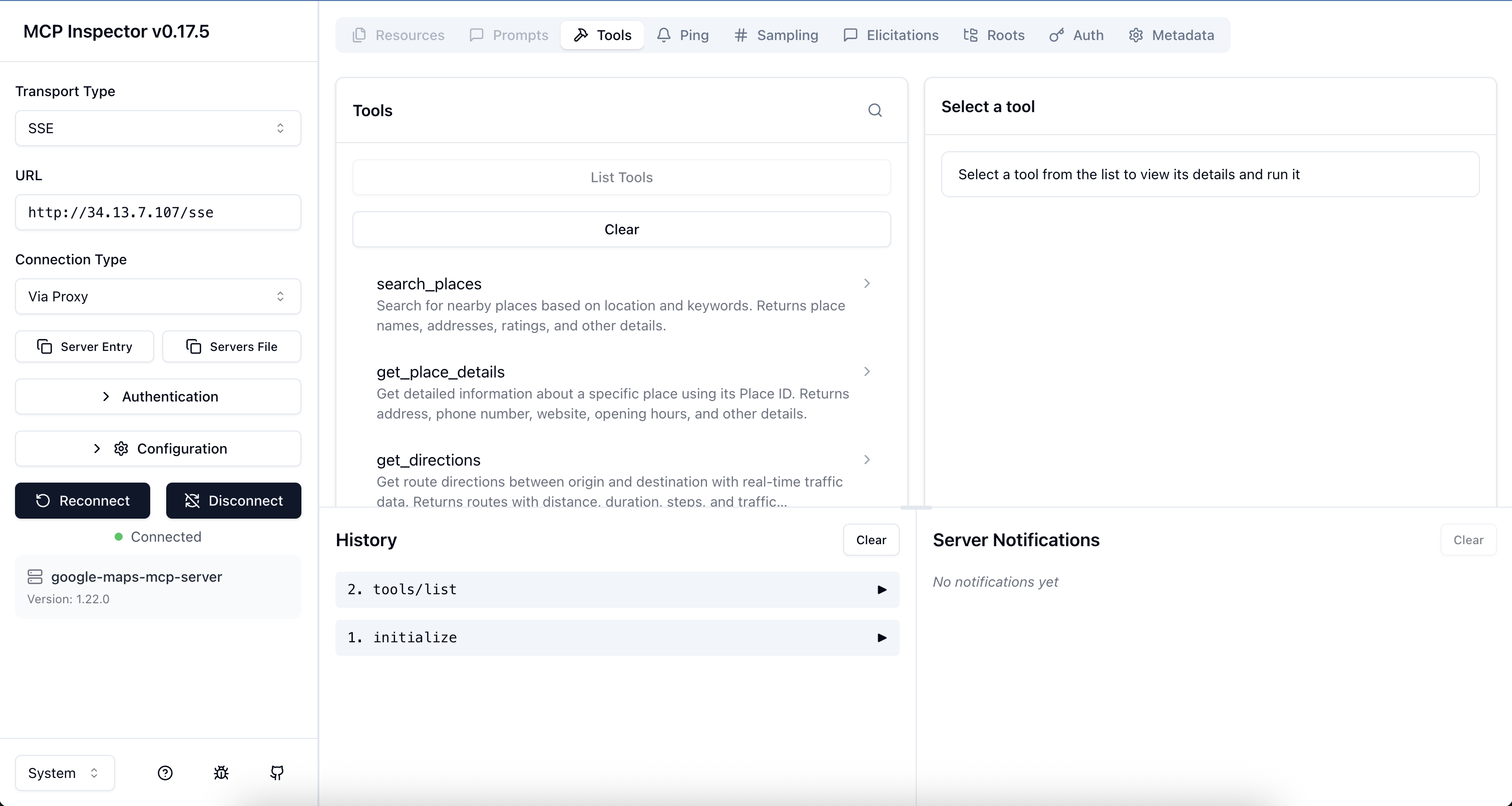
Run make help to see all available commands.
Add to your Claude Desktop configuration file:
macOS: ~/Library/Application Support/Claude/claude_desktop_config.json
Windows: %APPDATA%\Claude\claude_desktop_config.json
{
  "mcpServers": {
    "google-maps": {
      "command": "uvx",
      "args": ["google-maps-mcp-server"],
      "env": {
        "GOOGLE_MAPS_API_KEY": "your_api_key_here"
      }
    }
  }
}
Or if installed globally:
{
  "mcpServers": {
    "google-maps": {
      "command": "google-maps-mcp-server",
      "env": {
        "GOOGLE_MAPS_API_KEY": "your_api_key_here"
      }
    }
  }
}
Now you can ask Claude:
from google.adk.agents import Agent
from google.adk.tools.mcp_tool import MCPToolset
from mcp.client.stdio import StdioServerParameters

async def create_location_agent():
    # Connect to Google Maps MCP server
    maps_tools = await MCPToolset.from_server(
        connection_params=StdioServerParameters(
            command='google-maps-mcp-server',
            env={"GOOGLE_MAPS_API_KEY": "your_api_key_here"}
        )
    )

    # Create agent with Maps tools
    agent = Agent(
        name="location_intelligence_agent",
        model="gemini-2.0-flash",
        instruction="""You are a location intelligence assistant with access to
        Google Maps data. Help users with directions, place searches, and location queries.""",
        tools=[maps_tools]
    )

    return agent

# Use the agent
agent = await create_location_agent()
response = await agent.run("Find Italian restaurants near Hyde Park, London")
print(response)
import asyncio
from google_maps_mcp_server import GoogleMapsMCPServer, Settings

async def main():
    # Initialise with custom settings
    settings = Settings(
        google_maps_api_key="your_api_key_here",
        log_level="DEBUG",
        max_results=10
    )

    server = GoogleMapsMCPServer(settings)

    # Run the server
    await server.run()

if __name__ == "__main__":
    asyncio.run(main())
from google_maps_mcp_server.tools import PlacesTool, DirectionsTool
from google_maps_mcp_server.config import Settings

async def find_nearby_restaurants():
    settings = Settings(google_maps_api_key="your_key")
    places_tool = PlacesTool(settings)

    result = await places_tool.execute({
        "location": "51.5118,-0.1175",  # The Strand, London
        "keyword": "pizza",
        "radius": 1000
    })

    print(f"Found {result['data']['count']} pizza places")
    for place in result['data']['places']:
        print(f"- {place['name']}: {place['rating']}⭐")

asyncio.run(find_nearby_restaurants())
# Build the image
docker build -t google-maps-mcp .

# Run the container
docker run -it \
  -e GOOGLE_MAPS_API_KEY=your_maps_key_here \
  google-maps-mcp

# Or use docker-compose
docker-compose up
All configuration can be set via environment variables or .env file:
| Variable | Type | Default | Description |
|---|---|---|---|
GOOGLE_MAPS_API_KEY | string | required | Google Maps Platform API key (for Maps tools) |
LOG_LEVEL | string | INFO | Logging level (DEBUG, INFO, WARNING, ERROR, CRITICAL) |
MAX_RESULTS | integer | 20 | Maximum results to return (1-60) |
DEFAULT_RADIUS_METERS | integer | 5000 | Default search radius in meters |
MAX_RADIUS_METERS | integer | 50000 | Maximum allowed search radius |
MAX_RETRIES | integer | 3 | Maximum retry attempts for failed requests |
RETRY_MIN_WAIT | float | 1.0 | Minimum wait between retries (seconds) |
RETRY_MAX_WAIT | float | 10.0 | Maximum wait between retries (seconds) |
search_placesFind places near a location.
Parameters:
location (required): Coordinates as "lat,lng" or address stringkeyword (required): Search keyword (e.g., "restaurant", "petrol station")radius (optional): Search radius in meters (default: 5000, max: 50000)type (optional): Place type filter (e.g., "restaurant", "gas_station")Example:
{
  "location": "51.5118,-0.1175",
  "keyword": "coffee shop",
  "radius": 1000,
  "type": "cafe"
}
get_place_detailsGet detailed information about a specific place.
Parameters:
place_id (required): The unique Place IDfields (optional): Specific fields to retrieve (e.g., ["name", "phone", "hours"])Example:
{
  "place_id": "ChIJN1t_tDeuEmsRUsoyG83frY4",
  "fields": ["name", "website", "hours"]
}
get_directionsGet route directions with real-time traffic.
Parameters:
origin (required): Start location (address or coordinates)destination (required): End location (address or coordinates)mode (optional): Travel mode - "driving" (default), "walking", "bicycling", "transit"departure_time (optional): ISO 8601 timestamp for traffic estimationalternatives (optional): Return alternative routes (default: true)avoid (optional): Features to avoid - ["tolls", "highways", "ferries", "indoor"]traffic_model (optional): "best_guess" (default), "optimistic", "pessimistic"Example:
{
  "origin": "London, UK",
  "destination": "Manchester, UK",
  "mode": "driving",
  "alternatives": true,
  "avoid": ["tolls"]
}
get_traffic_conditionsAnalyze real-time traffic conditions between two locations.
Parameters:
origin (required): Starting locationdestination (required): Ending locationdeparture_time (optional): ISO 8601 timestamp (defaults to now)traffic_model (optional): "best_guess" (default), "optimistic", "pessimistic"Example:
{
  "origin": "London, UK",
  "destination": "Oxford, UK",
  "traffic_model": "best_guess"
}
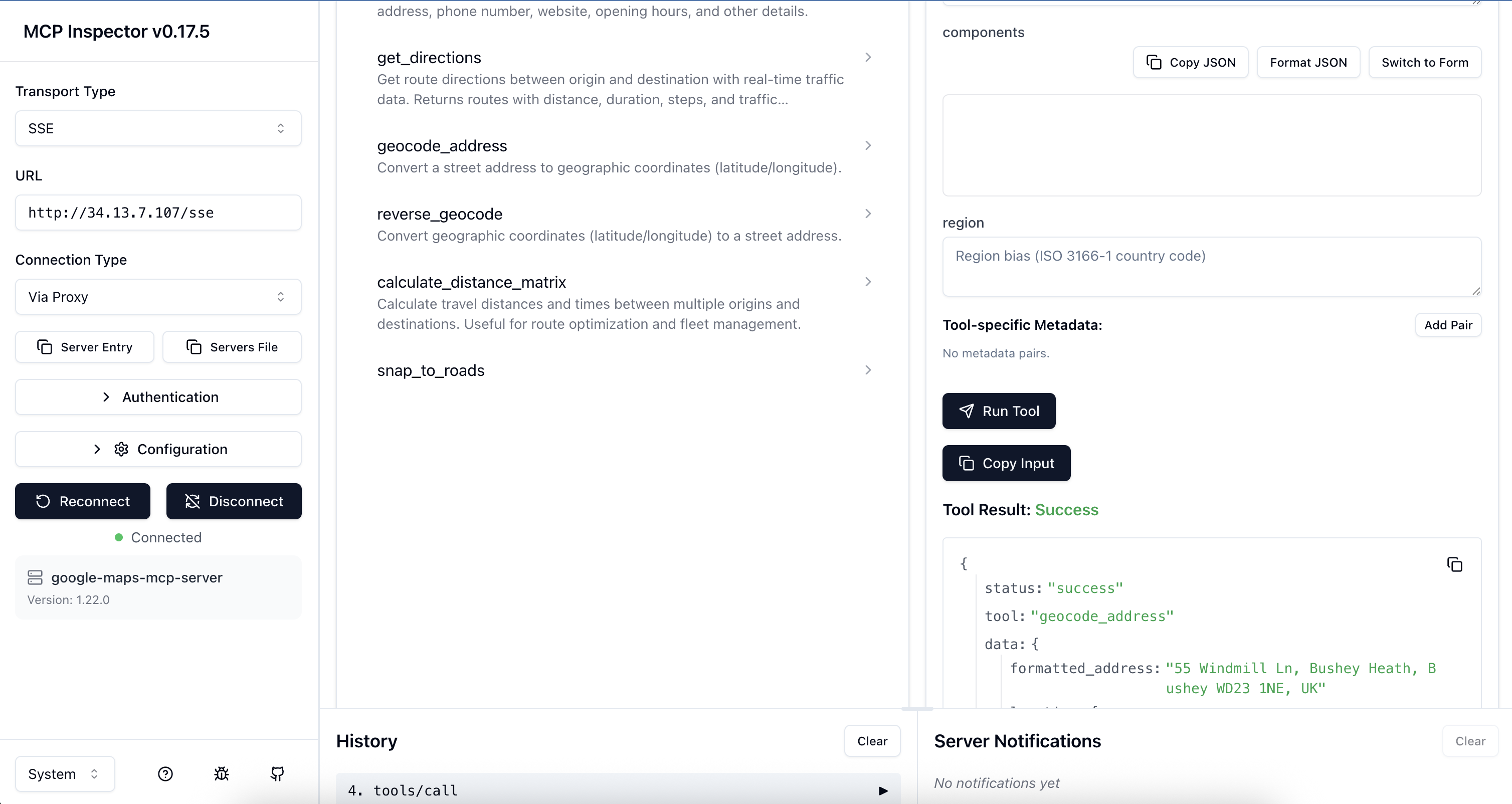
geocode_addressConvert an address to coordinates.
Parameters:
address (required): Street address to geocodecomponents (optional): Component filters (e.g., {"country": "GB"})region (optional): Region bias (ISO 3166-1 country code)Example:
{
  "address": "10 Downing Street, London, UK"
}
reverse_geocodeConvert coordinates to an address.
Parameters:
lat (required): Latitude (-90 to 90)lng (required): Longitude (-180 to 180)result_type (optional): Filter by result typesExample:
{
  "lat": 51.5034,
  "lng": -0.1276
}
calculate_distance_matrixCalculate distances and times between multiple locations.
Parameters:
origins (required): Array of origin locationsdestinations (required): Array of destination locationsmode (optional): Travel mode (default: "driving")avoid (optional): Features to avoidunits (optional): "metric" (default) or "imperial"Example:
{
  "origins": ["London, UK", "Manchester, UK"],
  "destinations": ["Birmingham, UK", "Leeds, UK"],
  "mode": "driving"
}
snap_to_roadsSnap GPS coordinates to the nearest road.
Parameters:
path (required): Array of GPS points with lat/lng (2-100 points)interpolate (optional): Fill gaps between points (default: true)Example:
{
  "path": [
    {"lat": 51.5034, "lng": -0.1276},
    {"lat": 51.5035, "lng": -0.1275}
  ],
  "interpolate": true
}
get_speed_limitsGet speed limit data for road segments.
Parameters:
place_ids (required): Array of place IDs from snap_to_roadsExample:
{
  "place_ids": ["ChIJwQ2rKwAEdkgRo7h2RYD1oUM"]
}
calculate_route_safety_factorsCalculate safety scores for a route based on traffic, road conditions, and speed limits.
Parameters:
origin (required): Starting locationdestination (required): Ending locationdeparture_time (optional): ISO 8601 timestamp (defaults to now)traffic_model (optional): "best_guess", "optimistic", "pessimistic" (default)Example:
{
  "origin": "London, UK",
  "destination": "Oxford, UK",
  "departure_time": "2023-10-27T23:00:00Z",
  "traffic_model": "pessimistic"
}
get_route_elevation_gainCalculate elevation gain and retrieve elevation profile for a route.
Parameters:
origin (required): Starting locationdestination (required): Ending locationmode (optional): "driving", "walking", "bicycling" (default)samples (optional): Number of elevation samples (default: 50, max: 512)Example:
{
  "origin": "London, UK",
  "destination": "Brighton, UK",
  "mode": "bicycling",
  "samples": 100
}
# Clone the repository
git clone https://github.com/ettysekhon/google-maps-mcp-server.git
cd google-maps-mcp-server

# Install uv if you haven't already
curl -LsSf https://astral.sh/uv/install.sh | sh

# Install dependencies with dev extras
uv sync --extra dev

# Set up pre-commit hooks
uv run pre-commit install
# Run all tests
uv run pytest

# Run with coverage
uv run pytest --cov=src --cov-report=html

# Run only unit tests
uv run pytest -m "not integration"

# Run specific test file
uv run pytest tests/unit/test_places.py

# Run with verbose output
uv run pytest -v
# Format code
uv run black src tests

# Lint code
uv run ruff check src tests

# Fix linting issues automatically
uv run ruff check src tests --fix

# Type checking
uv run mypy src

# Run all checks
uv run black src tests && \
uv run ruff check src tests && \
uv run mypy src && \
uv run pytest
# Build package
uv build

# Publish to PyPI (requires authentication)
uv publish

# Build Docker image
docker build -t google-maps-mcp-server:latest .
We welcome contributions! Please see CONTRIBUTING.md for guidelines.
git checkout -b feature/amazing-feature)uv run pytest)git commit -m 'Add amazing feature')git push origin feature/amazing-feature)This MCP server uses Google Maps Platform APIs which have the following considerations:
Cost Optimisation Tips:
alternatives=false for directions when not neededmax_results for place searchesSee Google Maps Platform Pricing for details.
API Key Security:
API Key Restrictions (Recommended):
Application restrictions: HTTP referrers or IP addresses
API restrictions:
  - Places API
  - Directions API
  - Geocoding API
  - Distance Matrix API
  - Roads API
Monitoring:
Problem: ValidationError: google_maps_api_key cannot be empty
GOOGLE_MAPS_API_KEY environment variable is setProblem: REQUEST_DENIED error
Problem: OVER_QUERY_LIMIT error
Problem: Server won't start
export LOG_LEVEL=DEBUG
google-maps-mcp-server
This project is licensed under the Apache License 2.0 - see the LICENSE file for details.
Run Claude Code as an MCP server so any agent can delegate coding tasks to it
Browser automation using accessibility snapshots instead of screenshots
Google's universal MCP server supporting PostgreSQL, MySQL, MongoDB, Redis, and 10+ databases
Official GitHub integration for repos, issues, PRs, and CI/CD workflows